


Luna County Precinct 4, Luna County, New Mexico
About
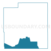
Outline

Summary
| Unique Area Identifier | 623706 |
| Name | Luna County Precinct 4 |
| County | Luna County |
| State | New Mexico |
| Area (square miles) | 334.49 |
| Land Area (square miles) | 334.49 |
| Water Area (square miles) | 0.01 |
| % of Land Area | 100.00 |
| % of Water Area | 0.00 |
| Latitude of the Internal Point | 31.86151830 |
| Longtitude of the Internal Point | -107.78519670 |
Maps


Graphs
Select a template below for downloading or customizing gragh for Luna County Precinct 4, Luna County, New Mexico


Neighbors
Neighoring Voting District (by Name) Neighboring Voting District on the Map
- Grant County Precinct 31, Grant County, NM
- Hidalgo County Precinct 6, Hidalgo County, NM
- Luna County Precinct 13, Luna County, NM
- Luna County Precinct 14, Luna County, NM
Top 10 Neighboring County Subdivision (by Population) Neighboring County Subdivision on the Map
- Deming South CCD, Luna County, NM (20,997)
- Hurley CCD, Grant County, NM (1,715)
- South Hidalgo CCD, Hidalgo County, NM (507)
Top 10 Neighboring Place (by Population) Neighboring Place on the Map
Top 10 Neighboring Unified School District (by Population) Neighboring Unified School District on the Map
- Deming Public Schools, NM (25,095)
- Silver City Consolidated Schools, NM (21,377)
- Animas Public Schools, NM (1,165)
Top 10 Neighboring State Legislative District Lower Chamber (by Population) Neighboring State Legislative District Lower Chamber on the Map
Top 10 Neighboring State Legislative District Upper Chamber (by Population) Neighboring State Legislative District Upper Chamber on the Map
Top 10 Neighboring 111th Congressional District (by Population) Neighboring 111th Congressional District on the Map
Top 10 Neighboring Census Tract (by Population) Neighboring Census Tract on the Map
- Census Tract 4, Luna County, NM (5,936)
- Census Tract 5, Luna County, NM (4,338)
- Census Tract 9700, Hidalgo County, NM (2,195)
- Census Tract 9648, Grant County, NM (1,764)